GIS Course
IDRAN offers GIS courses at various levels, customizable to meet your needs, available at your location or ours. For more information, contact us at info@idran.net.
WHO IS IT FOR?
The courses are aimed at professionals, technicians, and public administration officials. The modular structure of the courses makes them suitable for addressing a wide range of topics, providing tools and solutions for diverse professionals, including engineers, architects, geologists, surveyors, students, and anyone who needs to work with geographic or spatial information in their professional activities.
WHICH COURSE?
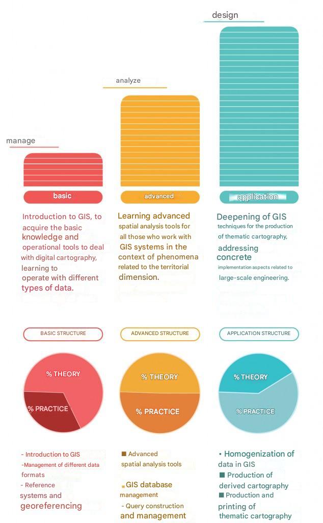
Users can independently structure their training path by selecting the courses that best suit their needs. These are three separate courses—not three modules—designed to ensure complete autonomy in using the tools learned by the end of each course. The practical application module can be tailored to user needs, focusing on specific projects related to large-scale engineering, such as drafting watershed management plans, network management, cadastral updates, or monitoring landslide phenomena.
Each course combines theoretical lessons with practical exercises of increasing complexity to address real-world project challenges hands-on.
OBJECTIVE!
BASIC COURSE:
Manage any type of data supported by GIS.
ADVANCED COURSE:
Analyze spatial data to efficiently mangage territorial databases.
APPLIED COURSE:
Design optimized solutions for producing derived and thematic cartography for large-scale engineering projects.


