Ingegneria Idraulica
TOPOGRAFIA, GEOLOGIA E MONITORAGGIO AMBIENTALE
 IDRAN esegue rilievi topografici/batimetrici ed indagini geognostiche per la conoscenza della morfologia e caratteristiche geologiche-geotecniche dei domini fluviali e marittimo-costieri e progetta/realizza sistemi per il monitoraggio idraulico/ambientale.
Gli strumenti e tecnologie IDRAN rappresentano lo stato dell’arte nelle indagini territoriali ed ambientali per il rilievo sul campo (GPS, laser scanner) e da sensore remoto (drone, lidar e sistemi satellitari).
Il team IDRAN si avvale di esperti in geologia, geomorfologia, geomatica per la progettazione del rilievo ed il processamento dei dati per lo sviluppo di Modelli Digitali del Terreno e delle Superfici(DTM e DSM) e svolge continuo aggiornamento nel mondo della ricerca applicata e professionale inerente l’Osservazione della Terra (Remote Sensing& Earth Observation).
STUDI IDRAULICI FLUVIALI E COSTIERI
 La geomorfologia, l’idrologia, l’idrogeologia e l’idraulica studiano la morfologia, la caratterizzazione geologico-strutturale e la dinamica dei processi fisici che determinano la distribuzione e la dinamica delle acque nell’atmosfera, sulla superficie terrestre (suolo e sottosuolo) e nei sistemi fluviali (reti idrografiche canalizzate naturali ed artificiali) e marittimo-costieri (aree portuali, depositi e terminal costieri, inshore ed offshore).
IDRAN si avvale di esperti in studi ed analisi scientifiche nel settore delle acque e sviluppa studi idraulici avanzati mettendo a frutto competenze specialistiche e modelli numerici e Sistemi Informativi Territoriali (GIS) per la modellazione dei processi fisici che caratterizzano i sistemi fluviali e marittimo-costieri (corsi d’acqua principali e bacini idrografici secondari, bacini portuali, terminal e depositi costieri).
OPERE IDRAULICHE E MARITTIME
PROGETTAZIONE OPERE IDRAULICHE E MARITTIME
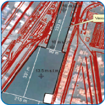 IDRAN sviluppa servizi di ingegneria per la progettazione di opere idrauliche e marittime con particolare riguardo a: sistemi di gestione e distribuzione delle risorse idriche (acquedotti e fognature, urbanizzazioni, depurazione), interventi di mitigazione del rischio idrogeologico (arginature, casse di espansione, sistemazioni fluviali), opere e bacini portuali, depositi e terminal costieri.
Gli strumenti e tecnologie IDRAN rappresentano lo stato dell’arte a supporto della progettazione delle opere dalla selezione ottimale dei siti (studio di fattibilità e Due Diligence) fino alla progettazione esecutiva.
IDRAN supporta clienti pubblici e privati nella progettazione e verifica tecnico-economica di interventi per la realizzazione e manutenzione di opere idrauliche e marittime coinvolgendo un team di esperti con vasta esperienza professionale.
DIREZIONE LAVORI
La IDRAN fornisce servizi di assistenza tecnica in tutte le fasi di realizzazione degli interventi a partire dalle attività preliminari in fase di pre gara, ricerca e selezione imprese specializzate, fino alla direzione e coordinamento lavori per la messa in opera del progetto.
Il personale IDRAN è particolarmente specializzato in opere complesse in ambiente fluviale e marittimo-costiero.
IDRAN si avvale di: – Project Manager – Direttori Lavori – Coordinatori della Sicurezza


