IDRAN specializes in the development and application of advanced commercial and experimental Information & Communication Technology (ICT) tools for the analysis, processing, interpretation, distribution and visualization of spatial and numerical data.
The programming of analytical tools and graphical user interfaces are peculiar IDRAN skills with specific regard to the development and application of custom Geographic Information System (GIS). IDRAN’s know how on GIS, on relational databases, together with the optimal use of field monitoring and Earth Observation (EO) data and tools, characterize IDRAN in-house innovative systems and advanced solutions.
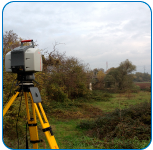
 IDRAN, thanks to it multidisciplinary team on the fields of hydrology, hydrogeology, geomorphology, and hydraulic offers an advanced service of organization, management and execution of survey and monitoring campaigns for water resources’ and in projects for hydraulic risk assessment. IDRAN take advantage of state of the art equipments for land monitory and aircrafts with GPS e LiDAR.
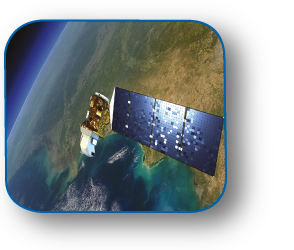
In addition to surveys, IDRAN take care of the management of data coming from remote sensing for the monitoring of large areas taking advantage of data from multiple Spatial Agencies.
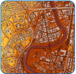
 IDRAN produce thematic cartography with particular atention to the production of maps related to anthropic and natural risk, water resources and environmental impact.
Thematic maps represent a valid tool for the development of engineering projects, land planning and environmental studies.

 Italiano
